
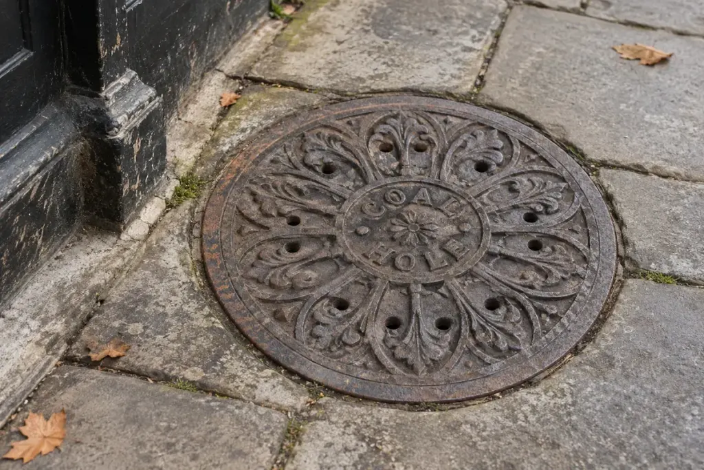
A patterned iron circle in an old pavement may be more than a utility cover. In some streets it marks a former coal-delivery opening, linking the public footway to storage beneath a house. It is a small reminder that everyday fuel once shaped the building’s service arrangements.
Historic England’s Georgian townhouse walking guide points out surviving circular cast-iron coal-hole covers in London. Its archive also records individual examples, useful for comparing details overlooked during a walk.
Read the surface before inventing a story
Look for the cover’s shape, texture, inscriptions and position relative to the building. A maker’s name can provide a research lead, but it does not necessarily date the house. A cover could have been replaced long after the original opening was built.
Nor is every round iron cover a coal hole. Compare the object with documented examples and the surrounding architecture before attaching a confident label.
Make a record without moving anything
Photograph from a safe position without obstructing pedestrians. Include one wider view to show the relationship with the frontage, then a close view of any legible marking. Record the location and date separately so the image remains useful later.
Do not lift, loosen or test the cover. It may belong to a live property arrangement, and the space below is not yours to inspect. An apparently decorative object still has a practical place in the pavement.
A local archive, historical map or building record may help establish how the street was serviced. Keep confirmed information distinct from a plausible interpretation.
The most interesting result may be a new question rather than an exact date: how did supplies reach the cellar, and how did that route change when the house stopped using coal? The cover gives that larger story a visible starting point.